| Description: |
|
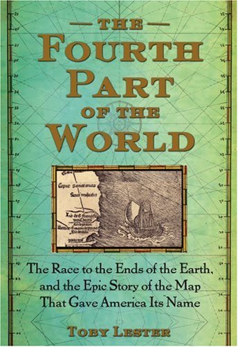
Product Description
"Old maps lead you to strange and unexpected places, and none does so more ineluctably than the subject of this book: the giant, beguiling Waldseemüller world map of 1507." So begins this remarkable story of the map that gave America its name. For millennia Europeans believed that the world consisted of three parts: Europe, Africa, and Asia. They drew the three continents in countless shapes and sizes on their maps, but occasionally they hinted at the existence of a "fourth part of the world," a mysterious, inaccessible place, separated from the rest by a vast expanse of ocean. It was a land of myth—until 1507, that is, when Martin Waldseemüller and Matthias Ringmann, two obscure scholars working in the mountains of eastern France, made it real. Columbus had died the year before convinced that he had sailed to Asia, but Waldseemüller and Ringmann, after reading about the Atlantic discoveries of Columbus’s contemporary Amerigo Vespucci, came to a startling conclusion: Vespucci had reached the fourth part of the world. To celebrate his achievement, Waldseemüller and Ringmann printed a huge map, for the first time showing the New World surrounded by water and distinct from Asia, and in Vespucci’s honor they gave this New World a name: America.
The Fourth Part of the World is the story behind that map, a thrilling saga of geographical and intellectual exploration, full of outsize thinkers and voyages. Taking a kaleidoscopic approach, Toby Lester traces the origins of our modern worldview. His narrative sweeps across continents and centuries, zeroing in on different portions of the map to reveal strands of ancient legend, Biblical prophecy, classical learning, medieval exploration, imperial ambitions, and more. In Lester’s telling the map comes alive: Marco Polo and the early Christian missionaries trek across Central Asia and China; Europe’s early humanists travel to monastic libraries to recover ancient texts; Portuguese merchants round up the first West African slaves; Christopher Columbus and Amerigo Vespucci make their epic voyages of discovery; and finally, vitally, Nicholas Copernicus makes an appearance, deducing from the new geography shown on the Waldseemüller map that the earth could not lie at the center of the cosmos. The map literally altered humanity’s worldview. One thousand copies of the map were printed, yet only one remains. Discovered accidentally in 1901 in the library of a German castle it was bought in 2003 for the unprecedented sum of $10 million by the Library of Congress, where it is now on permanent public display. Lavishly illustrated with rare maps and diagrams, The Fourth Part of the World is the story of that map: the dazzling story of the geographical and intellectual journeys that have helped us decipher our world.
Amazon.com Review
Amazon Exclusive: Simon Winchester Reviews The Fourth Part of the World
Simon Winchester studied geology at Oxford and later became an award-winning journalist, and author of more than a dozen books. He has written for The Guardian, Smithsonian Magazine, National Geographic, and has reviewed books for The New York Times. His bestselling titles include: The Man Who Loved China, The Professor and the Madman, and Krakatoa. The author divides his time between his home in Massachusetts and in the Western Isles of Scotland. Read Simon Winchester’s exclusive Amazon guest review of The Fourth Part of the World:
Books about obscure and unobvious commercial subjects, written with passion by stylish enthusiasts, have come in recent years to provide us a canon of the most valuable and lasting literature. Toby Lester, who appears to be a master of the language and a man evidently as inquisitive as a ferret, has written a quite wonderful book about something that is, yes, obscure and unobvious commercial--but which is a tale quite vital to anyone interested in knowing the story of this country. It is about the naming of America, and the creation of a document that has been lately and justly called this country's birth-certificate.
The document is a map--and so Mr. Lester's book is in essence about cartography, and sixteenth century cartography at that, a specialist's dream. But the tale of the making and then the hiding and the losing and the finding of this extraordinary and very large document--it called the Waldseemüller Map, and it now belongs to the Library of Congress--is sufficiently exciting to be almost unbearably thrilling. And anyone who can make cartography thrill deserves a medal, at the very least. The mapmakers in question were German: Martin Waldseemüller and his poetically-inclined colleague, Mathias Ringmann. Come the beginning of the sixteenth century, and working in southern France these two, like many in the European intellectual world, were beginning to hear rumors that a new continent had lately been found, halfway between Spain and Japan. (This was fifteen years after Columbus, who still had no clue what he had found in 1492--to his dying day he insisted that he had merely found a hitherto unknown piece of Asia.) The rumors swiftly became accepted fact: in the early 1500s the pair came across two printed accounts of the alleged new continent--accounts that were prolix, flamboyant, unreliable and in parts very saucy (there was material relating to the cosmetic self-mutilation, anal cleanliness and sexual practices of the locals) written by a colourful Italian explorer and sorcerer named Amerigo Vespucci. Crucially Vespucci claimed in one of these papers that “on this last voyage of mine…I have discovered a continent in those southern regions that is inhabited by more numerous peoples than in our Europe, Asia or Africa, and in addition I found a more pleasant and temperate climate than in any other region known to us…” As it happened, the mapmakers had already been commissioned to create a new world map--and so on it, they both agreed after reading Vespucci's accounts, they would now draw this new body of land, and they would give it a name. After some head-scratching they agreed the name should be the feminine form of the Latinised version of Amerigo Vespucci's Christian name: the properly feminine place-nouns of Africa, Asia and Europe would now be joined, quite simply, by a brand-new entity that they would name America. And so, in 1507, their map was duly published; and in large letters across the southern half of the southern continental discovery, just where Brazil is situated today, was the single word: America. It was written in majuscule script, was a tiny bit crooked, curiously out of scale and looking a little last-minute and just a little tentative--but nevertheless and incontrovertibly, it was there. It caught on: a globe published in Paris in 1515 placed the word on both segments of the continent, north and south. The word was published in many books in central Europe--Strasbourg in 1509, Poland in 1512, Vienna in 1520; it was found in a Spanish book in 1520. In Strasbourg, five years later, another book lists 'America' as one of the world's regions and finally, in 1538, Mercator, the new arbiter of the planet's geography, placed the names North America and South America squarely on the two halves of the fourth continent. And with that, the name was secure; and it would never be changed again. Toby Lester has done American history the greatest service by writing this elegant and thoughtful account of the one morsel of cartographic history that would shake the world's foundations. We are told that this is his first book: may we hope that he writes many more, for his is a rare and masterly talent. --SW (Photo © Setsuko Winchester)
Discover the Waldseemüller World Map from The Fourth Part of the World
Click on image to enlarge

Click to discover the Waldseemüller map legend |

This legend highlights an idea that's almost completely forgotten today: that the New World was remarkable to Europeans in 1507 because it lay not just to the west but also to the south. Read more | 
The portrait shown here is an idealized depiction of the ancient Greek sage Claudius Ptolemy. Read more | 
The portrait shown here, an obvious companion to the portrait of Ptolemy to its left, is an idealized portrait of Amerigo Vespucci...Read more | 
Here, printed in block letters on what we know today as Brazil, is the first use of the name America on a map. Read more |
|